
Pewee Valley Maps
Look at maps of Pewee Valley, Kentucky, and surrounding sites dating from as early as 1858 through today and trace Pewee Valley's development from tiny town to sixth class city.
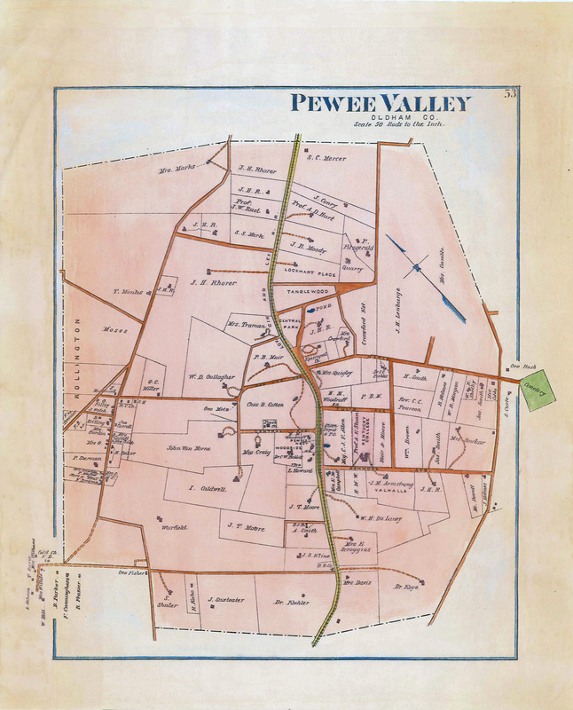
The 1879 Beers & Lanagan Atlas shows the names of property owners and the locations of their homes and local businesses nine years after Pewee Valley was incorporated
- G.T. Bergmann's Map of Jefferson County, Kentucky, 1858
- Beers & Lanagan Atlas of Pewee Valley, 1879
- Beers & Lanagan Atlas of Floydsburg & Rollington, 1879
- Beers & Lanagan Atlas of Anchorage & O'Bannons, 1879
- Villa Ridge Inn Subdivision Plat, 1889
- Turnaround Blueprint for Interurban, 1902
- Kentucky Confederate Home Campus Insurance Map, ca. 1906
- 1907 Property Owner Map of Pewee Valley
- 1929 City of Pewee Valley Insurance Map
- 1930s-Era Fox Studio Map
- Ca. 1939 WPA Pewee Valley Plat Map
- 1942 Highway Map of Pewee Valley
- 1953 District Map of Pewee Valley
- 1967 Grave Re-Interment in Pewee Valley Cemetery East
- 1970 Map of Pewee Valley Landmarks
- 1974 Proposed Plan for New Town Square
- 1974 Aerial View of Pewee Valley
- 1994 Pewee Valley Tour Map of 35 Landmark Homes
- Central Park Master Plan
- Confederate Hill Map, 2010
- National Register Properties and Historic Districts from the 1991 publication "Historic Pewee Valley"
- Pewee Valley Cemetery Map
- Subdivision Plats & Development
Related Links