Pewee Valley Historical Society
  • Home
  • Oral Histories
  • Places
  • People
  • Reference
  • Maps
  • About/Contact
    • About / Contact
    • Historical Society

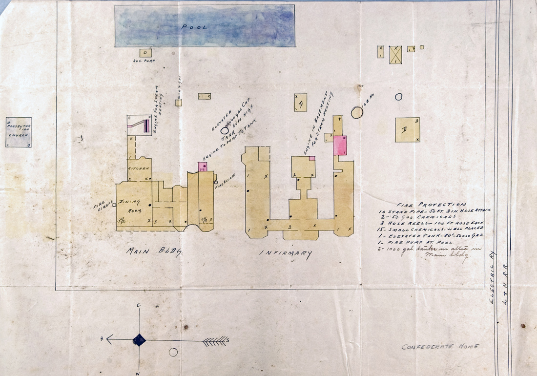
Kentucky Confederate Home Campus Insurance Map, ca. 1906

​This ca. 1906 insurance map of the Kentucky Confederate Home campus shows the locations of the main building (formerly the Villa Ridge Inn), the Infirmary building and the reservoir (marked "POOL"). The map was made prior to the erection of L.Z. Duke Hall in 1907. Courtesy of the Kentucky Historical Society.
Picture

Related Links
Kentucky Confederate Home​
Pewee Valley's Side of the Kentucky Confederate Home Story

A Visit to the Kentucky Confederate Home in 1915
What Became of the Home
The Confederate Burying Ground at Pewee Valley Cemetery
​
Videos of the 2010 Confederate Memorial Day Observation
Confederate Hill Map, 2010
© 2020
Donna Andrews Russell & 

The Pewee Valley Historical Society
Pewee Valley Kentucky
Picture
Picture
Picture
Pewee Valley Museum
P.O. Box 769
312 Mt. Mercy Drive
Pewee Valley, KY 40056
​502-241-8343

  • Home
  • Oral Histories
  • Places
  • People
  • Reference
  • Maps
  • About/Contact
    • About / Contact
    • Historical Society